Geographical analysis
Department of Geography & GIS

Department of Geography & GIS

Geographical analysis
DOI: 10.53989/bu.ga.v12i1.23.3
Year: 2023, Volume: 12, Issue: 1, Pages: 18-29
Original Article
M U Thejaswini1*, Arun Das2, M Ravi Kumar3, Sushant Sawant Anil4
1Research Scholar, DOS in Geography, University of Mysuru, Mysuru, 570006, India
2Professor, DOS in Geography, University of Mysore, Mysuru, 570006, India
3Assistant Professor and HOD, Department of Geography, Sri Adichunchangiri college of Arts, Commerce and Science, Nagamangala, Karnataka
4Assistant Professor and Co-ordinator, Division of Geoinformatics, Dept of Water & Health, JSS AHER, Mysuru, 570015, India
*Corresponding Author
Email: [email protected]
Received Date:02 February 2023, Accepted Date:28 May 2023
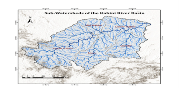
Lakes are formed naturally as well by human interference. Most of the time the landforms act as a congenial element in the formation of human based lakes. In the case of the natural lakes, the formation itself is an interesting aspect on the relief and topographical phenomenon. The study area is the Kabini, the main tributary of the Cauvery river. The river basin location is between 11⁰ 37’ 10” to 12⁰ 50’ 30” North latitude and 75⁰ 22’ 25” to 76⁰ 58’ 02” East longitude. In this research paper, the Remote sensing techniques and GIS (Geographical Information System) environment is used to analyze the formation and assemblage of lakes. The research area is delineated using ALOS PULSAR 12.5 DEM. The water bodies are extracted using the satellite image of 1993 and 2021, the Sentinel 2 satellite image. The main objective of this research paper is to understand the topography over the formation and assemblage of lakes. The lakes are studied on the basis of its Geomorphological assemblage which signifies the paleo climate, the present climate as well the future scenario of lakes. Secondly, it signifies the geology of that region and also a clear indicator of the underground water. Thus, this analysis is based on the Geomorphological analysis of lakes has been done on the basis of the lake location and its assemblage in relationship and influence with the Geology, slope, rainfall, relief, drainage density and land use and land cover. The research paper examines the inter-relationship between each one of these parameters and its limitations.
Keywords: Alos Pulsar, Dem (Digital Elevation Model), Sentinel 2, Paleo Climate
.
© 2023 Thejaswini et al. This is an open-access article distributed under the terms of the Creative Commons Attribution License, which permits unrestricted use, distribution, and reproduction in any medium, provided the original author and source are credited.
Published By Bangalore University, Bengaluru, Karnataka
Subscribe now for latest articles and news.