Geographical analysis
Department of Geography & GIS
Department of Geography & GIS
Geographical analysis
DOI: 10.53989/bu.ga.v14i2.24.16
Year: 2025, Volume: 14, Issue: 2, Pages: 1-4
Original Article
R Soundarya1, Sawant Sushant Anil1∗
1School of Life Sciences, JSS Academy of Higher Education and Research, Mysuru, Karnataka, India
*Corresponding Author
Email: [email protected]
Received Date:02 March 2024, Accepted Date:13 August 2024
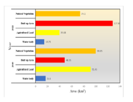
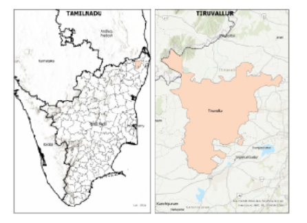
The detection of Land Use and Land Cover changes with the help of Remote Sensing data plays an important role in informed decision-making in various aspects. This study focuses on the assessment of Land use and Land cover changes of Thiruvallur District for the years 2010 and 2023. Utilizing Landsat 5 and Landsat 8 (OLI, TIRS) which is acquired from USGS Earth Explorer website, unsupervised classification techniques were employed to analyze the land use and land cover patterns. The accuracy assessment revealed satisfactory results with the user’s and producer’s accuracy which yielded overall accuracy of 90% and 92% respectively. This research provides valuable insights into the LULC changes occurring Thiruvallur District, which is essential for informed decision-making in land conservation, sustainable development, and water resource management.
Keywords: Land use and land cover, Change Detection, Accuracy, Remote Sensing, Thiruvallur District
© 2025 Soundarya & Sushant Anil. This is an open-access article distributed under the terms of the Creative Commons Attribution License, which permits unrestricted use, distribution, and reproduction in any medium, provided the original author and source are credited.
Published By Bangalore University, Bengaluru, Karnataka
Subscribe now for latest articles and news.